|
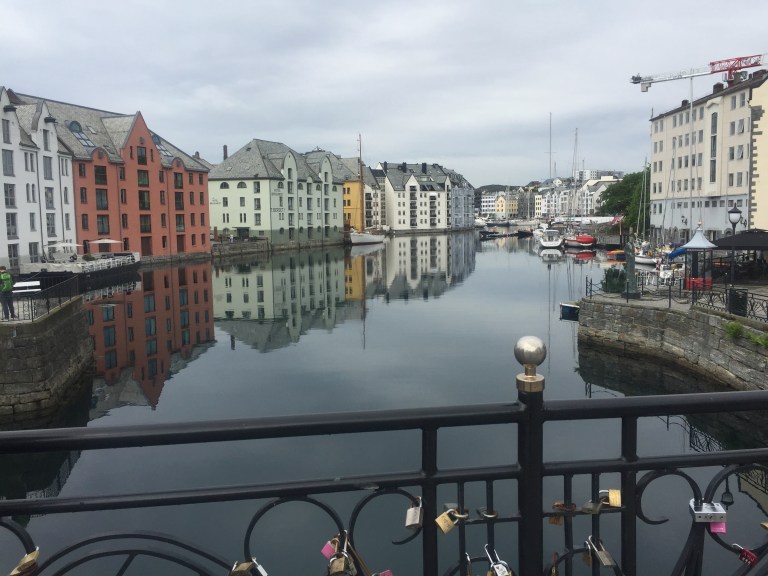
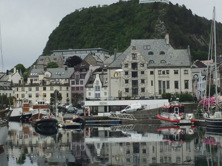
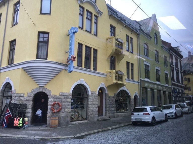
Ålesund, Norway
Thursday, June 15, 2017
|
After breakfast we departed for our full day tour of Norwegian Fjords.
We set off to explore Norway’s famed western fjords starting off by commercial ferry and a short scenic drive to the tiny port town of Hellesylt.
Our first ferry ride was about 15 minutes. We then crossed through many tunnels. We see snow on the mountain tops, sheep and goats grazing in the fields, cascading waterfalls, lots of grassy roof homes,
We pass by several furniture manufacturing businesses
The skies are overcast
After lunch, we headed to Gudbrandsjuvet Gorge to view underground waterfalls. We ended our adventure by traveling on Trollstigen Road (known as Troll road–there are lots of souvenir shops with little Trolls for sale), one of Norway’s most sought-after tourist attractions, known for its sharp hairpin turns.
From there, we cruised the Geirangerford, a UNESCO World Heritage designation. This spectacular natural wonder offers breathtaking views of towering mountains and cascading waterfalls. For lunch,
we visited the scenic Valldalen Valley, after traveling on “Eagles’s Road,” known for
both its breathtaking views of the fjord and its steep climb.


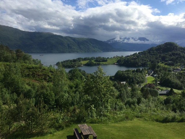

Valldal is the 30-kilometre-long valley going from the fjord in the south to the famous Trollstigen in the north. It is a fertile valley (known for strawberries and fruit) surrounded by alpine mountains. Valldal is in the south-east corner of Møre og Romsdal county in West Norway The village Sylte at the Norddalsfjord (a branch of Storfjord) is the centre of this agricultural district. Norddalsfjord is the northern branch of Storfjord, while the more famous Geirangerfjord extends to the south. Valldal is the western border of the Reinheimen – Norway’s youngest national park. Valldal is surrounded by attractive alpine mountains and steep, green hills. A wild river runs through the valley creating several nice waterfalls, including Holsfossen (10 kilometres upstream), Gudbrandsjuvet (15 km upstream) and Skjerdsura (16 km upstream) – these waterfalls are next to the road. Upper section of the valley, towards Trollstigen. Despite the northern latitude, Valldal has a mild climate and is famous for cherries, apples, raspberries, and strawberries produced on a commercial scale. The thick forests are home to a large number of red deer, roe deer and other wild animals. In the high mountains towards the east, rein deer and wolverine enjoy endless wilderness. Road 63 through Valldal connects, Trollstigen and Geiranger, two of Norway’s major attractions, to each other. Because of its natural beauty, involving both wild, alpine mountains, green fertile valleys and deep fjords, and impressive road constructions, the route was previously called the Golden Route. Now the stretch is named one of Norway’s 18 National Tourist Route. The Minister of transport inaugurated all of the 18 routes in a ceremony at iconic Trollstigen mountain pass. From Sylte (Valldal village) there is a local road to Tafjord, a tiny village at the mouth of a wild, narrow valley. From Tafjord village the road leads to the 100-metre-high Zacahricasdammen, a concrete water dam in the extensive Tafjord hydro power production system. This is also the gateway to the network of paths and huts in the Tafjord mountains, the western part of Reinheimen national park. Nature and wilderness is Valldal’s prime attraction. Waterfalls, gorges, alpine mountains, glaciers, and lakes are all around. Norwegian nature is free to anyone, but it’s offered as it is – only the most accessible dangerous places are protected with fences and signs. Do not walk on glaciers without proper training and equipment. Be extremely careful on slippery slopes (particularly near waterfalls).
- 1 Trollstigen mountain pass (Road 63). summer only (late May – October). The Trollstigen, a mountain road climbing the pass between Isterdalen valley in the North and Valldal valley in the South. This iconic road is the major attraction in this area and one of the most visited destinations in Norway. It is a elegant road and engineering achievement amidst iconic mountains and wild waterfalls. Part of road 63 between Åndalsnes and Geiranger, designated as one of Norway’s national tourist routes. During high season the traffic load is high at noon (11 to 14 o’clock), traffic jams occur, try to drive early morning or evening.Free.
- “The snake” – a geological formation in the cliffs above Valldal village (Sylte).
- 2 Gudbrandsjuvet gorge, Road 63 (15 km from Valldal). All day, all year. The gorge and waterfall at Gudbrandsjuvet (15 kilometers upstream). The dry stone bridge across the gorge constructed in the 1920s as part of the Valldal-Åndalsnes road is still in use. The main river runs through a narrow (5 metres) and deep (25 metres) gorge, in fact a series of large “giant’s kettle”. The gorge is so narrow and complex that it is hard to see all even if the road runs across and there is an elaborate system of viewing platforms for visitors. Lovely rapids/waterfalls at Skjerdsura (boulders) just north of Gudbrandsjuvet along the road. According to the Sagas, king Olaf the Saint built the first road through the Skjerdsura boulders in year 1028. Free.
- 6 Muldalsfossen (Drive towards Tafjord, hike.). 24 hour. Muldalsfossen (waterfall) is a strange waterfall on the road between Tafjord and Valldal. The waterfall is hidden in a steep gorge and exit height is not known, about 200 m. Best viewed from the abandoned farm on the shelf (about 1 hour hike uphill). Be extremely careful on the slopes around the waterfall, fatal accidents have happened.
This evening, we return to our respective hotels for a Norwegian dinner with
entertainment.
Overnight: Storfjord Hotel


